08.08.2021 Schauer- und Gewitterthread

Hier findest du aktuelle Wettermeldungen & Unwetterinfos aus Österreich
Forumsregeln
Bitte im Titel Datum (DD.MM.YYYY) angeben.
Antworten
Benutzeravatar
jfk
Beiträge: 7026
Registriert: Samstag 30. Juni 2012, 21:15
Wohnort: Pernegg an der Mur

Sonntag 8. August 2021, 08:13

Guten Morgen!

Bild
A level 2 was issued across parts of Austria into extreme N/NE Italy mainly for large hail and excessive rain.
Both level 2 areas are surrounded by level 1 areas with similar hazards but with lower probabilities. In addition a few severe wind gusts are possible over Austria.
... N Italy into Austria ...

Once again, a passing wave interacts with a moist/unstable air mass and creates a favorable environment for organized convection.
Models keep CI mainly along the orography next to the passing wave with strongest forcing. Although CI is less likely further S over N Italy, not much capping and some QG forcing also affects this area during peak heating. One caveat will be the intrusion of drier (downslope) air from the W.
Kinematics remain excellent with DLS in the 25-30 m/s range and 0-3 km shear approaching 20 m/s in a few places (especially within the level 2 area). Strong veering with height and increasing strength of the background flow create elongated and curved hodographs.

CI is forecast beyond noon with a mix of multicells/supercells. One concern is the intense 0-3 km moist 20 m/s inflow into these cells, which supports temporal back-building and excessive rain. Otherwise, numerous rotating updrafts contain large hail and severe wind gusts. Main limiting factor for a more robust outbreak will be the southward sagging cold front with a cooler/more stable postfrontal air mass - convection could turn more elevated while racing to the NE. The hail risk however could extend all the way into W Slovakia.

An nocturnal cluster with elevated convection will continue E/NE and will cross Slovakia into S Poland. Heavy rain and isolated hail will be the main issue. Dependant on the magnitude of MUCAPE, a spotty large hail event can't be ruled out (especially if IFS verifies). This risk however seems too low in the poor man's ensemble to upgrade for now. Moisture advection into S Poland ahead of this wave has to be monitored closely as not much BL modification is needed for a more pronounced severe wind gust/hail threat into S Poland.
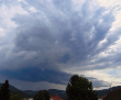
Quelle: ESTOFEX (https://www.estofex.org/)
Liebe Grüße, Johannes,
Pernegg an der Mur (Bez. Bruck-Mürzzschlag (ca. 10 km südlich von Bruck an der Mur))
Benutzeravatar
jfk
Beiträge: 7026
Registriert: Samstag 30. Juni 2012, 21:15
Wohnort: Pernegg an der Mur

Sonntag 8. August 2021, 11:55

Heftige Zelle (vermutlich Superzelle) an der italienischen-slowenischen Grenze:

Bild

Bild

Quelle: Radarska Slika Padavin (http://meteo.arso.gov.si/met/sl/weather/observ/radar/)
Liebe Grüße, Johannes,
Pernegg an der Mur (Bez. Bruck-Mürzzschlag (ca. 10 km südlich von Bruck an der Mur))
Benutzeravatar
Crakil
Beiträge: 149
Registriert: Samstag 2. Mai 2020, 22:00
Wohnort: Kumberg / Deutschfeistritz

Sonntag 8. August 2021, 13:59

Bisher beschränken sich die intensiven Zellen auf Norditalien und Nordslowenien. Kärnten bekommt dann die abregnenden Eisschirme ab. Auslöse in Kärnten wird dadurch eher unterdrückt.
cobra39
Beiträge: 2309
Registriert: Donnerstag 5. Dezember 2013, 11:42
Skype: nein
Wohnort: Neunkirchen/N.Ö.

Sonntag 8. August 2021, 14:17

Nördlich von Udine 2 x hintereinander eine heftige Gewitter (Super?) Zelle!!!
LG Helmut

Standort:
Peisching/Neunkirchen/südl. NÖ
Seehöhe: 400 m
Benutzeravatar
jfk
Beiträge: 7026
Registriert: Samstag 30. Juni 2012, 21:15
Wohnort: Pernegg an der Mur

Sonntag 8. August 2021, 15:36

Heftige Superzelle in SLO:

Bild

Quelle: Radarska Slika Padavin (http://meteo.arso.gov.si/met/sl/weather/observ/radar/)

In der Südsteiermark bereits tiefe Bewölkung mit Abschattung.
Liebe Grüße, Johannes,
Pernegg an der Mur (Bez. Bruck-Mürzzschlag (ca. 10 km südlich von Bruck an der Mur))
Benutzeravatar
Crakil
Beiträge: 149
Registriert: Samstag 2. Mai 2020, 22:00
Wohnort: Kumberg / Deutschfeistritz

Sonntag 8. August 2021, 17:29

Eine kleine Zelle hat den Sprung ins Klagenfurter Becken überlebt und hat sich nun bei Wolfsberg verstärkt. Möglicherweise schafft sie es nach Voitsberg und weiter ins Grazer Bergland.

Update 17:50: Es hat die Zelle zerrissen. Aktuell keine Blitzaktivität mehr. Mal sehen, ob sie überlebt.
Benutzeravatar
Feli
Beiträge: 22195
Registriert: Freitag 20. März 2009, 08:46
Skype: felisky
Wohnort: Aschach/Steyr
Kontaktdaten:

Sonntag 8. August 2021, 18:35

hier kommt ein gewitter aus SW an - bissi geregnet hats schon - der kern kommt aber noch
kein wind
liebe grüsse
(die) Feli
Bild
Aschach/Steyr/OÖ 435m, Wetterstation: Davis Vant-Vue
I took a heavenly ride through our silence, I knew the waiting had begun. And headed straight into the shining sun -D. Gilmore
Schneefrosch 2017/2023
Eisfrosch 2020/21
Benutzeravatar
Matthias
Beiträge: 6569
Registriert: Sonntag 19. April 2009, 19:43

Sonntag 8. August 2021, 19:17

Aktuell die "gröbste" Zelle genau über Liezen/Ennstal.

Damit schon knapp am ROTEN Bereich des Forecast-Bereichs.
Spannende Stunden kommen da nun auf uns zu - Überraschungen sind noch drinnen.

Interessant wird es jedenfalls, was da ÜBERHAUPT noch passieren soll im Süden - ob der Abschattung tagsüber.

Trockener Durchgang möglich!
lg,
Matthias

8072 Fernitz-Mellach, Graz-Umgebung

Wetterstation Fernitz: http://www.awekas.at/de/instrument.php?id=14717
Benutzeravatar
Pete
Beiträge: 1087
Registriert: Freitag 3. Juli 2009, 14:36
Wohnort: Waltersdorf a.d. March / NÖ / Bez. Gänserndorf

Sonntag 8. August 2021, 22:16

Gewitter ist hier durch, sollte aber noch ein bissl Regen nachkommen.
Mäßiger Wind, ein bissl blitzerei, aber nichts nahes, 4,1 mm.
Hätte ich aufgrund der ganztägigen Abschattung nicht damit gerechnet …
Liebe Grüße
Peter
Wohnort: Waltersdorf a.d. March / NÖ / Bez. Gänserndorf(48,52° N 16,88° E, 160 m)
Arbeit: Wien 22
Benutzeravatar
hhkes
Beiträge: 14608
Registriert: Montag 10. Januar 2011, 19:25
Wohnort: Feldkirchen bei Graz

Sonntag 8. August 2021, 22:56

Die (von Johannes oben beschriebene) massive SZ, welche vom Raum Ljubljana über Celje in den Raum Ptuj gezogen ist, hat schwere Schäden verursacht :!:
Bild dieser Zelle (von Nina Polšak):

Bild

Hagelkörner aus dem Raum Žalec (etwas westlich von Celje, von Nives Sesko via neurje.si):

Bild

Schäden durch Hagel an einem Wartehäuschen in Žalec (von Aleš Krautberger via neurje.si):

Bild

LG, Harald
FG, Standort Feldkirchen bei Graz
CM, Standort Campus MedUni Graz
Antworten