
verbreitet level 2 in Ö
quelle: https://www.estofex.org/
Storm Forecast
Valid: Sat 08 Jun 2024 06:00 to Sun 09 Jun 2024 06:00 UTC
Issued: Fri 07 Jun 2024 23:21
Forecaster: PISTOTNIK
A level 1 and level 2 are issued for parts of France, Switzerland, S Germany, Austria, N Italy, the Czech Republic, S Poland, Slovakia, Hungary and Slovenia for large hail, excessive convective precipitation and severe convective wind gusts.
DISCUSSION
... central Europe ...
Aided by plentiful evaporation and converging winds, rich low-level moisture accumulates along the mentioned frontal boundary, often resulting in 2m dewpoints in the 15-18C range. Similar or even slightly better low-level moisture also resides on the southern side of the Alps, further away from the frontal zone. In conjunction with steep lapse rates aloft that detach from the Sahara, the Iberian Plateau and the main Alpine crest and move eastward, CAPE between 500 and 1500 J/kg can be realized across many areas, possibly up to 2000 J/kg in N Italy, Slovenia and adjacent Hungary, where the capping will be stronger, though.
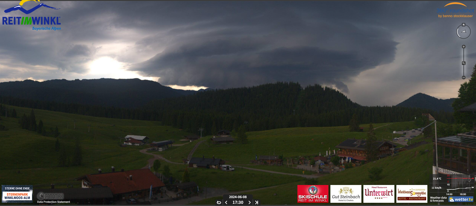
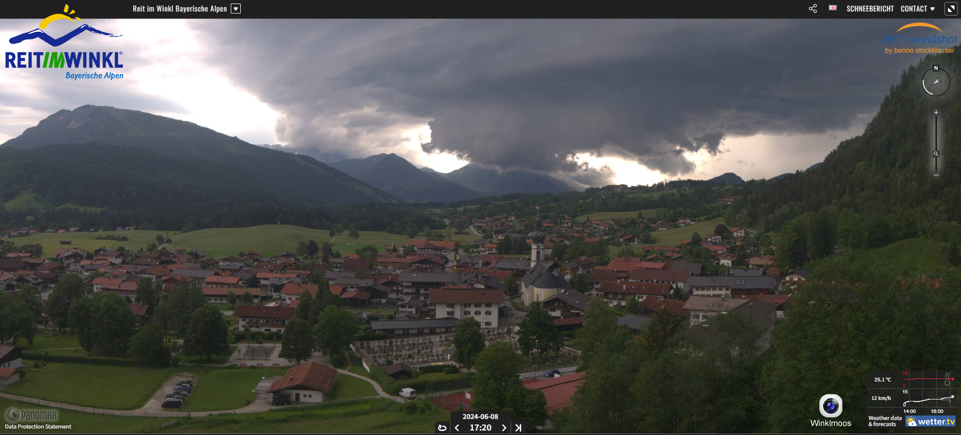
At least scattered thunderstorms are expected to initiate near the frontal boundary as well as over orographic features. Under 0-6 km shear around 20 m/s, 0-3 km shear around 15 m/s and veering wind profiles (the latter especially in the warm sector of the German/Polish frontal wave), an organization into multicells, some supercells, bowing line segments and later probably several large clusters is expected. Some swaths of large hail, severe wind and excessive rain events meeting level 2 criteria are likely to occur. The hail hazard, including a possibility of a few very large hail events, is highest with early, discrete storms, especially towards the south and southeast (e.g., E and S Austria, Slovenia, N Italy, but also E Slovakia), where local initiation at drylines downstream of the Alps or High Tatras, further enhanced CAPE and shear in the Alpine pumping regime and more subtle synoptic forcing are factors favoring undisturbed supercellular structures.
While the model pool does not fully agree on the timing and placement of storms, there is a fairly good agreement that the highest storm coverage will originate over E France, Switzerland and S Germany in the afternoon, aided by a conjunction of synoptic, mesoscale and orographic lift as the the most distinct mid-level vorticity maximum passes and transforms the frontal boundary into a cold front. These storms will increasingly affect Austria, the Italian Alps and possibly Slovenia towards evening.
More scattered storms are possible all along the frontal boundary further upstream and downstream, though less synoptic lift - or even weak synoptic subsidence - along with less prominent mountains will keep storm coverage lower over W France as well as over Hungary and Slovakia (with exception of the High Tatras, see above) during peak heating hours. Another source of uncertainty is how far northward the frontal wave can draw the moist, CAPE-laden warm sector into the Czech Republic or even Poland. The majority of the models increases convection signals there only in the evening and overnight, reducing the chances for surface-based and severe storms to some degree. As a compromise, the level 1 is extended northward into the Czech Republic, but not into Poland. Nonetheless it is worth mentioning that 0-1 km shear strongly increases to 10-15 m/s across the northern half of Poland near the cyclone center, hence surface-based storms forming there would unfold an enhanced hazard of producing severe wind gusts and one or two tornadoes. This scenario appears too conditional for a level 1, but is worth being kept in mind.
While convection will peak in the afternoon and evening, some storms can continue well into the night if enough lift support from mid-level vorticity maxima is present. However, they will gradually turn elevated and weaken then.