Auch heute warnt ESTOFEX in Südösterreich vor schweren Gewittern.
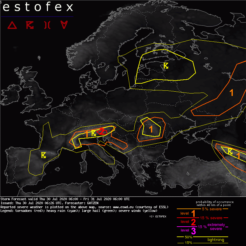
A level 2 was issued across southern Austria into Italy and Slovenia mainly for large hail.
Southern Alps and northern Italy
At the anticyconically sheared right entry of the mid-level jet, a very unstable air mass is situated south of the Alps. Latest dewpoint reading indicate lower 20s and steep lpase rates are indicated by latest models, that forecast high MLCAPE in the afternoon. Initiation of storms is expected around noon over the southern and central Alps. With high CAPE and moderate shear that gradually increases towards the north-east to around 15 m/s DLS, clusters and multicells are expected. Supercells are not ruled out especially across the highlighted level 2 area. Large or very large hail are forecast, along with locally heavy rain and severe wind gusts.
Less confidence is expected across northern Italy, given some capping inversion and weak QG forcing. However, storms may spread into the low-lands in the afternoon along their leading gusts fronts. Due to very high MLCAPE in excess of 2000 J/kg, an MCS is not ruled out, capbale of producing severe wind gusts.