VERLÄNGERUNG DER UNWETTERWARNUNG - Gefahr von Starkregen, Sturmböen und Hagel im Norden

Heute sollten die Gewitter etwas schwächer ausfallen, aber dennoch warnwürdig (v.a. in den bereits betroffenen Gebieten).


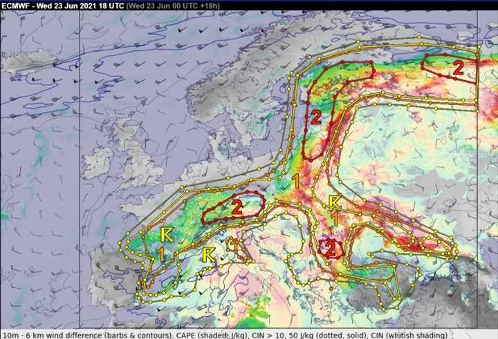
S Germany to N Austria and SW / central Czech Republic ...
In response to the lee cyclogenesis behind the Alpine range, a WAA regime will develop across the N Alp slopes/forelands with northeasterly to easterly flow at the surface. Towards the evening hours, a subtle short-wave is forecast to cross the area, igniting thunderstorm initiation. 500 to 1500 J/kg of MLCAPE is forecast across the area, increasing towards the N Alpine flanks across Austria. In the afternoon to evening hours, vertical wind shear will become very favorable for supercells and intense linear segments with long hodographs (0-3 km bulk shear between 15 - 25 m/s) and SRH locally exceeding 250 m2/s2 in the 0-3 km layer.
A mixed-mode of isolated supercells and bowing segments is possible in the scenario with the most intense storms tracking along the N-Alpine rim. All hazards will be possible with large to very large hail and damaging wind gusts being the chief ones. Wind gust threat will ramp up as storms cluster into an MCS that may track towards the S Czech Republic during the night hours. A level 3 was considered for the border area between SE Germany / NW Austria, but given the rather skinny CAPE profiles and potential cloudiness spoiling the surface heating, decided to stay with a level 2.

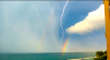
 erste Tropfen aus der bayernzelle fallen bei uns runter, hoffe Kachelmann hat nicht recht mit der zugrichtung sonst wird das heute ein Volltreffer - das braucht man nicht

Hallo.


Auch von hier aus zu sehen, hohe Blitzfrequenz. Mal sehen, wie lange die Zelle durchhält, Bedingungen müssten ganz gut sein.wetterfan18 hat geschrieben: ↑Mittwoch 23. Juni 2021, 23:05 Stroboskopwetterleuchten mit extrem vielen Wolkenblitzen von hier aus gut sichtbar.