das wär dann heute für meine gegend wieder "mittendrin statt nur dabei"
laut kachelmann und zamg für heute in OÖ warnung vor gewittern ab ca. 14 - 15 uhr
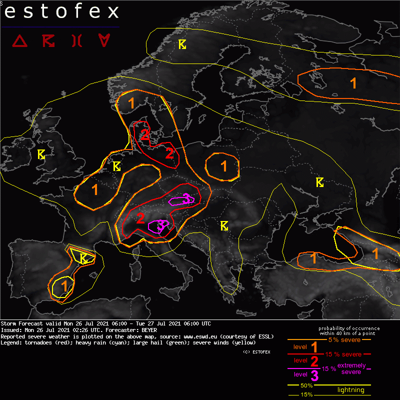
auszüge aus der warnung, vielleicht mag ja noch wer was dazu schreiben?
www.estofex.orgStorm Forecast
Valid: Mon 26 Jul 2021 06:00 to Tue 27 Jul 2021 06:00 UTC
Issued: Mon 26 Jul 2021 02:26
Forecaster: BEYER
A level 3 was issued along the northern Alpine rim in Austria mainly for (very) large hail, (extreme) severe wind gusts, and excessive precipitation.
A level 2 was issued for the surrounding Greater Alpine region mainly due to the same threats but with less likelihood for extreme events.
SYNOPSIS
A long-wave trough is persistently situated over Western Europa that has an independent center over NW France and the North Sea. Central and Eastern Europe are lying on the forward flank of this through in a diffluent upper-level flow. Warm and humid airmasses are present in all of this area.
Several short wave features are traveling northeastward leading to maxima in the omega field, responsible for the different regions of interest.
The trough axis is situated over E Spain and travels slowly eastward throughout the forecast period.
Another but weaker trough can be found over SE Europe. NE Turkey and the Caucasus region is situated on its forward flank.
NW Russia is influenced by the rear flank of another trough. A cold front is passing this area from north to south. Thereafter cool airmasses spread that region with a northwesterly flow.