In Italien geht es aber in der Früh schon ordentlich zur Sache
25.06.2017 Schauer und Gewitterthread
Forumsregeln
Bitte im Titel Datum (DD.MM.YYYY) angeben.
Bitte im Titel Datum (DD.MM.YYYY) angeben.
-
Hannes
Aus den Karnischen wird's dunkel dauergedonnere...
Edit: Strassenbeleuchtung schaltet sich wieder ein (dunkel)
st. Regen hat eingesetzt
Edit: Strassenbeleuchtung schaltet sich wieder ein (dunkel)
st. Regen hat eingesetzt

Seit kurz nach 7 Uhr Regen, 8mm bisher. Immer wieder ordentliche Rumpler dabei die 20-30 Sekunden dauern, das geht nur mit gscheitem Echo in den Alpen. 
Standort: Oberhalb von Schwaz in Tirol auf knapp 900m

Hallo:
Gewitter in der Nacht war auch hier nur ein Streifschuss ... es gab kurzzeitig Starkregen und massive Naheinschläge.
Heute wird's spannend im Süden, unser Chasing-Team trifft sich um ca. 11 Uhr bei Papa Harald.
Gewitter in der Nacht war auch hier nur ein Streifschuss ... es gab kurzzeitig Starkregen und massive Naheinschläge.
Heute wird's spannend im Süden, unser Chasing-Team trifft sich um ca. 11 Uhr bei Papa Harald.
Liebe Grüße, Johannes,
Pernegg an der Mur (Bez. Bruck-Mürzzschlag (ca. 10 km südlich von Bruck an der Mur))
----------------------------------------------------------------
Wetterstation: Davis Vantage Pro 2
Pernegg an der Mur (Bez. Bruck-Mürzzschlag (ca. 10 km südlich von Bruck an der Mur))
----------------------------------------------------------------
Wetterstation: Davis Vantage Pro 2
-
Hannes
kräftiger gewitter durchsetzter Regen ...
18,0mm bis dato
die Natur lächtzt nach regen...
18,0mm bis dato
die Natur lächtzt nach regen...
-
tiger26
Estofex hat mittlerweile ein MD drinnen (hier der Auszug) und Ihr habt ja auch einen super Forecast drinnen (jetzt erst gesehen, mein Favorit ist direkt aufs Forum gesetzt  )
)
Currently ongoing MCS in N Italy is electrically very active and move slowly to the east producing high amounts of precipitation and downburst-type severe wind gusts. Confirmed hail reports indicate hailstones up to 5-6cm. In the following hours system will move to S Austria and Slovenia posing enhanced risk for severe weather.
Along with increasing vertical wind shear and helicity over SE Austria / N Slovenia / W Hungary (SE surface winds will increase SRH to 100-200 m2/s2), cells developing along converging winds will likely evolve into multicells and supercells capable of producing large hail, severe wind gusts and heavy rain. In the late afternoon along with increasing LL shear, a chances for a tornado event will increase. Given high relative humidity in the low to mid troposphere (PW > 40mm) and a possibility of slowly moving multicell clusters, a risk for severe flash flooding event within Alpine area will be possible.
Wahnsinn welche Hagelgrößen entstehen können:
https://www.facebook.com/EUStormMap/" onclick="window.open(this.href);return false;
https://www.facebook.com/EUStormMap/pho ... 48/?type=3" onclick="window.open(this.href);return false;
Zuletzt geändert von tiger26 am Sonntag 25. Juni 2017, 10:20, insgesamt 2-mal geändert.
-
chris-wels

- Beiträge: 7326
- Registriert: Montag 20. April 2009, 22:13
- Wohnort: Thalheim bei Wels/Salzburg
Siezenheim, vor 1h setzte leichter Regen ein, wird stärker. sehr feucht hier
jetzt 1 dumpfer lauter Grummler aus Süd, wohl wieder nette Spielereien aus dem oberen Stockwerk (riesiger Schirm)
lg chris
jetzt 1 dumpfer lauter Grummler aus Süd, wohl wieder nette Spielereien aus dem oberen Stockwerk (riesiger Schirm)
lg chris
Schneeschauer, Regenschauer, Graupelschauer, Bierschauer
5072 Siezenheim, 431m [X] // 4600 Thalheim bei Wels OÖ, 317m [ ]
5072 Siezenheim, 431m [X] // 4600 Thalheim bei Wels OÖ, 317m [ ]

-
chris-wels
- Beiträge: 7326
- Registriert: Montag 20. April 2009, 22:13
- Wohnort: Thalheim bei Wels/Salzburg
3 sehr bassige Donner hier aus Süd zu hören, dazu ergiebiger Regen. Gut für die Böden.
im Süden heute gefährliche LAge, vor allem noch zugespitzt in Oberitalien und Slowenien. Dort gute Scherung, starke lapse-rate und sehr viel Energie in der Luft!
Könnte durhcaus was gewaltiges aus der aktuellen Linie Grenze SLO/Ita werden
lg chris
ps: und gerade der nächste Rumpler
im Süden heute gefährliche LAge, vor allem noch zugespitzt in Oberitalien und Slowenien. Dort gute Scherung, starke lapse-rate und sehr viel Energie in der Luft!
Könnte durhcaus was gewaltiges aus der aktuellen Linie Grenze SLO/Ita werden
lg chris
ps: und gerade der nächste Rumpler
Schneeschauer, Regenschauer, Graupelschauer, Bierschauer
5072 Siezenheim, 431m [X] // 4600 Thalheim bei Wels OÖ, 317m [ ]
5072 Siezenheim, 431m [X] // 4600 Thalheim bei Wels OÖ, 317m [ ]
leichter Regen hat eingesetzt. laut Radar kommt hinten mehr nach.
Standort: Sierning bei Steyr/O.Ö. , Seehöhe: 330 m
Wetterstation: Vantage Pro2
Web: http://www.wetter-hausruckviertel.at" onclick="window.open(this.href);return false;
Wetterstation: Vantage Pro2
Web: http://www.wetter-hausruckviertel.at" onclick="window.open(this.href);return false;

Hier noch nix, aber es scheint heftig zu werden...
Wir brechen jetzt auf.
LG, Harald, Johannes und Thomas, FG
P.S.: Georg (Pistotnik) stösst auch noch zu uns
Wir brechen jetzt auf.
LG, Harald, Johannes und Thomas, FG
P.S.: Georg (Pistotnik) stösst auch noch zu uns
FG, Standort Feldkirchen bei Graz (Davis Vantage Pro 2)
CM, Standort Campus MedUni Graz
CM, Standort Campus MedUni Graz
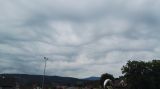
Hier in Klagenfurt wirds, denk ich, auch bald böse losgehen. Es kommt eine weße Wand auf uns zu und eine Shelfcloud...
LG, Bernhard
[x]Lienz (Nord), auf ca. 700 m
[] Seblas, Gde. Matrei in Osttriol, 975 m
[] Klagenfurt am Wörthersee, Welzenegg (Nordost), 439 m
[x]Lienz (Nord), auf ca. 700 m
[] Seblas, Gde. Matrei in Osttriol, 975 m
[] Klagenfurt am Wörthersee, Welzenegg (Nordost), 439 m

BITTE BENUTZT unser MELDEFORMULAR für euer WETTERMELDUNGEN!
jeder kann/darf das (vereinsmitglieder benutzen bitte den HP-internen link)!
jede eingabe wird noch einmal überprüft - somit kann keiner was falsch machen
DANKE!!!
=>>>> Link zum Meldeformular für ALLE
jeder kann/darf das (vereinsmitglieder benutzen bitte den HP-internen link)!
jede eingabe wird noch einmal überprüft - somit kann keiner was falsch machen
DANKE!!!
=>>>> Link zum Meldeformular für ALLE
liebe grüsse
(die) Feli
Aschach/Steyr/OÖ 435m, Wetterstation: Davis Vant-Vue
I took a heavenly ride through our silence, I knew the waiting had begun. And headed straight into the shining sun -D. Gilmore
Schneefrosch 2017/2023
Eisfrosch 2020/21
(die) Feli
Aschach/Steyr/OÖ 435m, Wetterstation: Davis Vant-Vue
I took a heavenly ride through our silence, I knew the waiting had begun. And headed straight into the shining sun -D. Gilmore
Schneefrosch 2017/2023
Eisfrosch 2020/21
viel erfolg euch!hhkes hat geschrieben:Hier noch nix, aber es scheint heftig zu werden...
Wir brechen jetzt auf.
LG, Harald, Johannes und Thomas, FG
P.S.: Georg (Pistotnik) stösst auch noch zu uns
liebe grüsse
(die) Feli
Aschach/Steyr/OÖ 435m, Wetterstation: Davis Vant-Vue
I took a heavenly ride through our silence, I knew the waiting had begun. And headed straight into the shining sun -D. Gilmore
Schneefrosch 2017/2023
Eisfrosch 2020/21
(die) Feli
Aschach/Steyr/OÖ 435m, Wetterstation: Davis Vant-Vue
I took a heavenly ride through our silence, I knew the waiting had begun. And headed straight into the shining sun -D. Gilmore
Schneefrosch 2017/2023
Eisfrosch 2020/21
So bis jetzt hats nur kräftig geschüttet. Kaum Blitz und Donner. Aber das Hauptfeld kommt erst.
EDIT11:46: jetzt schüttets wieder mehr, auch etwas mehr Wind.
EDIT11:46: jetzt schüttets wieder mehr, auch etwas mehr Wind.
Zuletzt geändert von Berni79 am Sonntag 25. Juni 2017, 11:48, insgesamt 1-mal geändert.
LG, Bernhard
[x]Lienz (Nord), auf ca. 700 m
[] Seblas, Gde. Matrei in Osttriol, 975 m
[] Klagenfurt am Wörthersee, Welzenegg (Nordost), 439 m
[x]Lienz (Nord), auf ca. 700 m
[] Seblas, Gde. Matrei in Osttriol, 975 m
[] Klagenfurt am Wörthersee, Welzenegg (Nordost), 439 m
lt. Wetteronlineradarprognose solls hier um 13 Uhr gewittern. bin gespannt.
Standort: Sierning bei Steyr/O.Ö. , Seehöhe: 330 m
Wetterstation: Vantage Pro2
Web: http://www.wetter-hausruckviertel.at" onclick="window.open(this.href);return false;
Wetterstation: Vantage Pro2
Web: http://www.wetter-hausruckviertel.at" onclick="window.open(this.href);return false;

na da bin ich auch gespannt!rudolf hat geschrieben:lt. Wetteronlineradarprognose solls hier um 13 Uhr gewittern. bin gespannt.
ich wär ja schon mal froh, wenns zumindest so viel regnen würd, dass der warme boden nicht gleich wieder alles wegtrocknen würd
seit gut 1 stunde tröpfelts jetzt vor sich hin
takt. 21,9°C
tp. 16,2°C
zumindest riechts draussen herrlich nach nasser erde
liebe grüsse
(die) Feli
Aschach/Steyr/OÖ 435m, Wetterstation: Davis Vant-Vue
I took a heavenly ride through our silence, I knew the waiting had begun. And headed straight into the shining sun -D. Gilmore
Schneefrosch 2017/2023
Eisfrosch 2020/21
(die) Feli
Aschach/Steyr/OÖ 435m, Wetterstation: Davis Vant-Vue
I took a heavenly ride through our silence, I knew the waiting had begun. And headed straight into the shining sun -D. Gilmore
Schneefrosch 2017/2023
Eisfrosch 2020/21